An important issue in computational seismology is the estimation of possible ground motion due to seismic waves after an earthquake. To answer this questions an assumed subsurface model and earthquake source are taken as initial condition for the simulation of the propagation of the resulting waves.
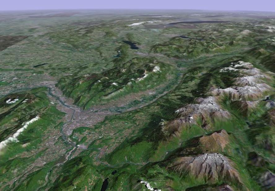
An international benchmark test considers the region around the city of Grenoble in the French Alpes (see right). Detailed information of the topography, the elastic and damping parameters of the sedimentary layers in the valley and in the underlying basement rock, as well as a clearly defined kinematic earthquake source are known and can be translated into a discrete model required by the numerical computations.
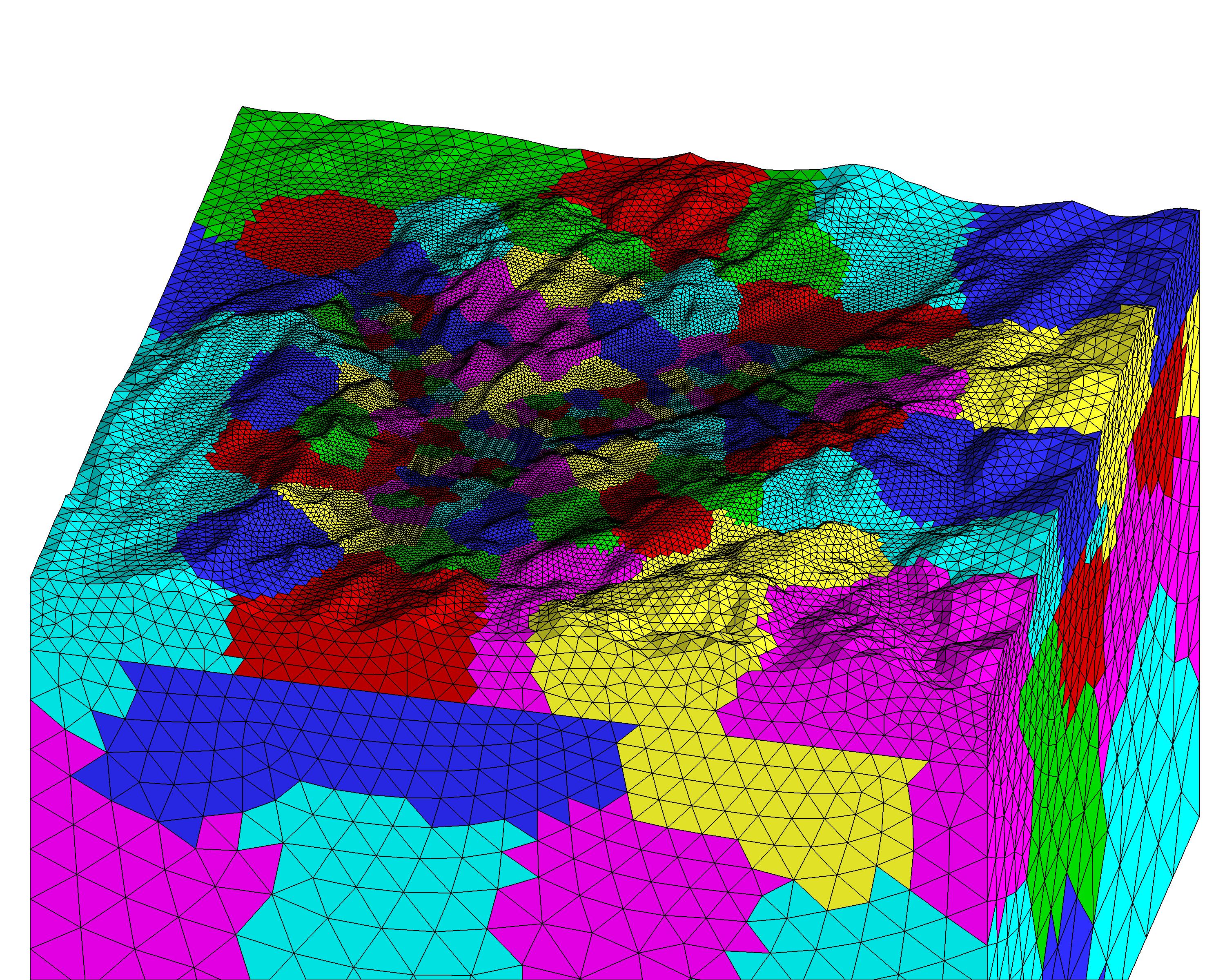
The discrete model is partitioned into a number of different pieces (subdomains)
that are sent to different processors on a multi-processor supercomputer in order
to reduce the computational time.
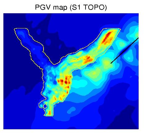
At the surface the ground motion is recorded by a dense network of seismic receivers.
Plotting the maximum ground motion on the surface provide the so-called
peak ground motion or peak ground velocity (PGV) maps, where red colors indicate areas of strong shaking and
blue colors the areas of very ground motion.